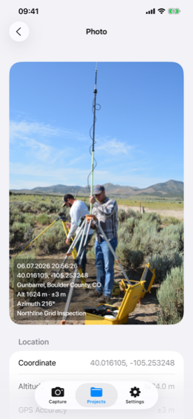
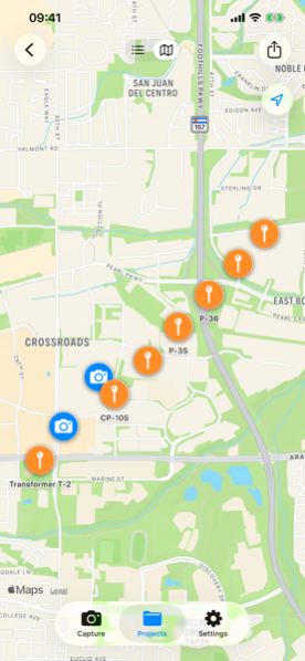
Photos stamped with coordinates, date, address, altitude, GPS accuracy and compass heading — plus one-tap waypoints and the export formats your office already uses.
Free: 2 projects, 20 records each — enough to try it on a real job.
Pro unlocks unlimited projects and records, all exports, PDF reports, UTM/MGRS formats and raw+stamped dual save. 14-day free trial.
Explore
Field-accurate photos, office-ready exports into your GIS software.
Log poles, valves and boundary corners in one tap — no photo required.
Built on AVFoundation and Core Location for best-accuracy GPS.
The same GPS survey camera, tuned for Android with CameraX.
An honest, feature-by-feature comparison before you switch.
No, not to start. The free tier gives you 2 projects with 20 records each — enough to try it on a real job. Terramark Pro unlocks unlimited projects and records, all export formats and PDF reports as a subscription with a 14-day free trial.
Yes. Capturing photos and waypoints works fully offline. Street addresses resolve automatically and get added to your records once your device is back online.
Yes. Every record can display coordinates in Decimal, DMS, UTM or MGRS format, and Pro exports (CSV, GeoJSON) include the UTM zone and EPSG code for GIS software like QGIS or ArcGIS.
Yes, Terramark is available on both the Apple App Store and Google Play with the same feature set.
No. There are no accounts and no cloud sync — your photos, coordinates and projects stay on your device. The app sends only anonymous crash and usage telemetry, never your content.